On Friday January 19 the CGWA, member of the Columbia Gorge Recreation Coalition, rented a full size Greyhound type bus and took a tour of the windsurfing sites. We invited the congressional aides from Oregon and Washington, Directors of Oregon and Washington State Parks and the Forest Service. Also on board were representatives from the Friends of the Gorge and the Gorge Commission.
CGWA printed up a Program. Page #1 Page #2We started at Viento, and the group walked out to the beach to take a look at the launch site. Ken Maddox described the work that had been done by CGWA and how a partnership had been formed with Oregon Parks & Recreation. Here is a map showing the plans for Viento.
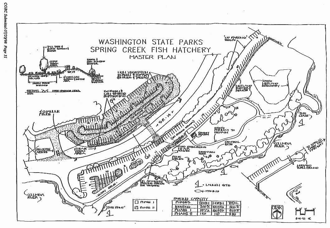
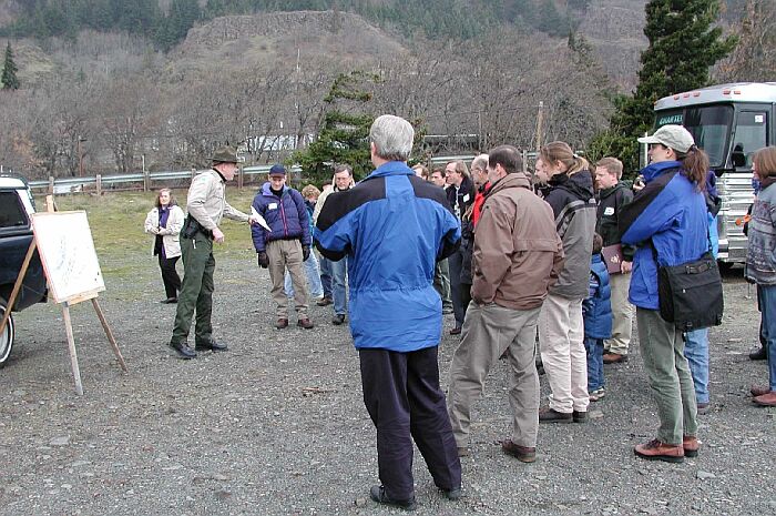
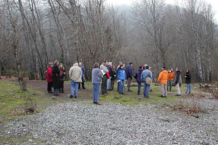
We then drove to the Hatchery, and one of the Washington State Parks rangers by the name of Andy Kallinen gave a presentation in the gravel parking lot. He had a map showing a two phased plan for improvements to the Hatchery. After he had finished speaking, we went over and looked at the launch area on the point. There was an audible groan from the group when they saw all the rocks that people had to go over to get into the water.
Rowena was the second stop where Ken Maddox discussed how the CGWA had worked with Oregon Parks and many other groups to take Rowena from being just an open field to the park that it is today. He described how people had donated heavy equipment to make the roads and clean up the junkyard on the beach. He also stressed the fact that sensitive wet lands had been protected even though it meant loosing access to a nice sandy beach.
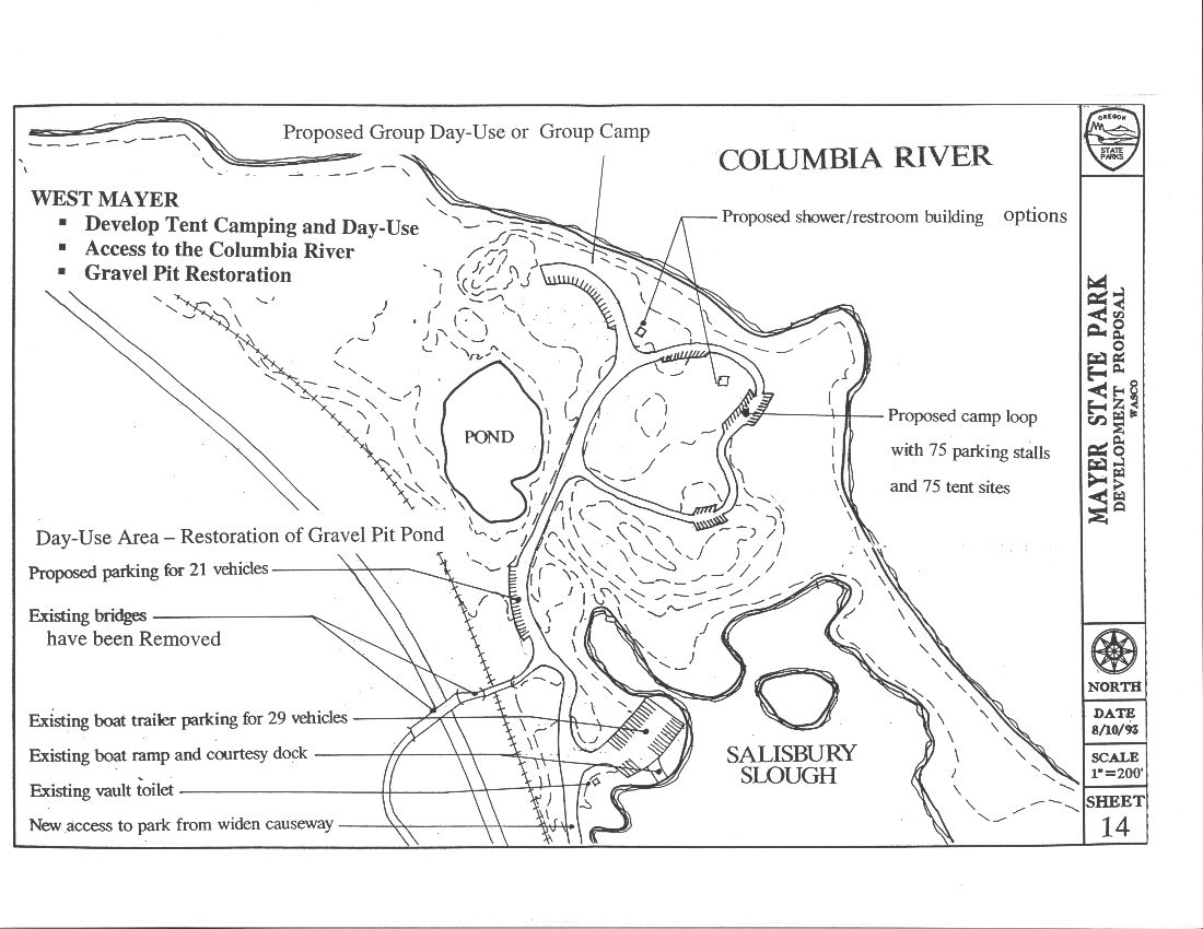
We then went down to the other end of this area which is called West Mayer. There is a new road which was installed in 1999 that replaces the access over the old wooden bridge. We drove beyond the parking lot and up into the unimproved area at the West end. Jack Wiles from Oregon Parks spoke to the group. His vision is for some type of camping or day use area near the river with improved access to the large pond which is just to the South. Here is his map. As we were standing there, someone spotted a Bald Eagle in a tree watching us.
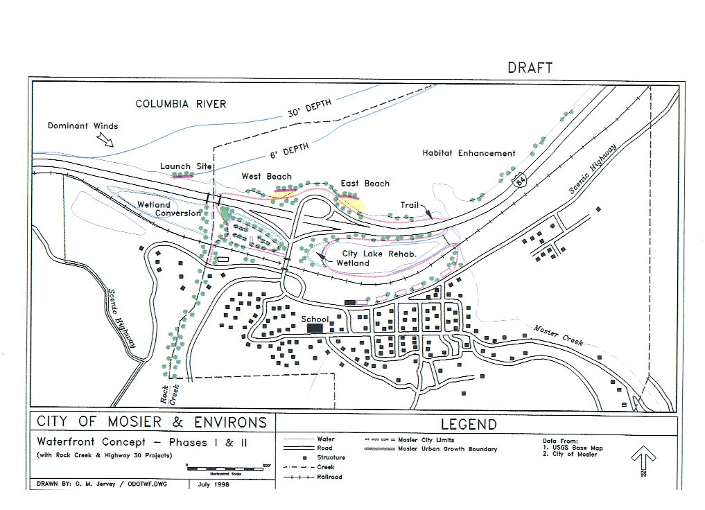
We then drove back I-84 to Mosier where some of residents had a nice table setup with coffee, cookies and pastry. They had a map setup and it showed the plans for improving the lake area and the Rock Creek launch. This site has been partially funded and work will start this spring. We then drove up to the Hatfield parking lot at the entrance to the Mosier Twin Tunnel trail and Gay Jervey, a local geologist told us about how this area was formed. She also told us about plans for changing this area from a gravel pit to a natural outdoor performing arts arena. We then drove back down to Rock Creek where we discussed briefly the 1996 flood and what it had done to the Rock Creek sailing area. Rock Creek Flood Pictures
Our next stop was back at Viento where we picked up our cars and headed home. Having talked with some of the congressional aids about how they choose projects to fund, I know that this type of activity gets their attention.